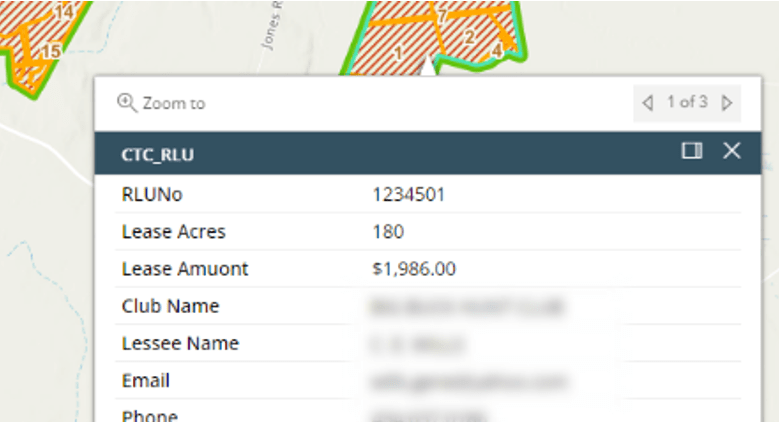
Rec Lease data in FM map
RLMS client users can now see the lease details in the map from FIP. Users can get contact information about the clubs without having to login to the RLMS admin site to contact them.
Thanks to the efforts of all the Team members, we are excited to announce a few updates we have been working on for the last few months.
RLMS client users can now see the lease details in the map from FIP. Users can get contact information about the clubs without having to login to the RLMS admin site to contact them.
As new timber sale contracts are added, the system checks for any existing hunting leases on the property. When the harvest activity gets started, hunt clubs are notified to keep the roads clear for logging crews. Land managers also have the option to send out these alerts manually at any time during the harvest process from the contract details page.
Users can access PTV and Atlas applications from FIP. Login info is managed in FIP and cannot be updated from external apps. This is only available for FIP clients who are also licensed to have access to PTV and Atlas applications.

This is a new feature that will help users track and fix any errors that might have occurred during the editing process. It also helps catch any missed updates that are caused by connectivity or sync issues with ArcGIS Online.
Regrid parcel layer is now part of FIP. Users have access to the premium Regrid Nationwide Parcel dataset with extended attribute information. This layer is provided with the standard FIP data layers as part of the existing FIP license without any additional cost.
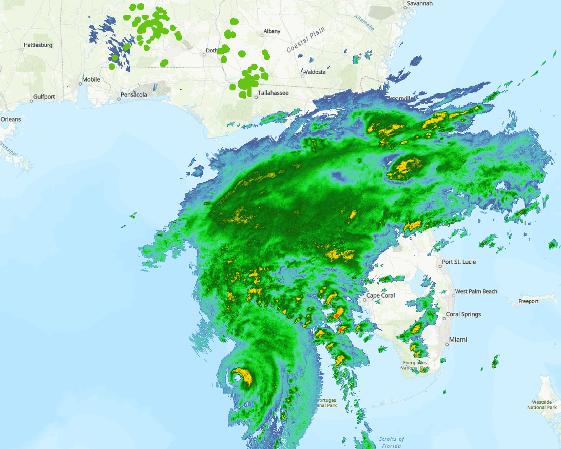
National Weather Service radar map is part of the standard data layers in FIP. This makes tracking storms and other weather events that affect your timberland a bit easier by overlaying the storm tracker on the tract boundaries. Radar map and hurricane track layers are live data services provided by NOAA and NWS.
Complete this short questionnaire to help us connect with you more easily!
Complete this short questionnaire to help us connect with you more easily!
Complete this short questionnaire to help us connect with you more easily!
Complete this short questionnaire to help us connect with you more easily!
Complete this short questionnaire to help us connect with you more easily!
Complete this short questionnaire to help us connect with you more easily!